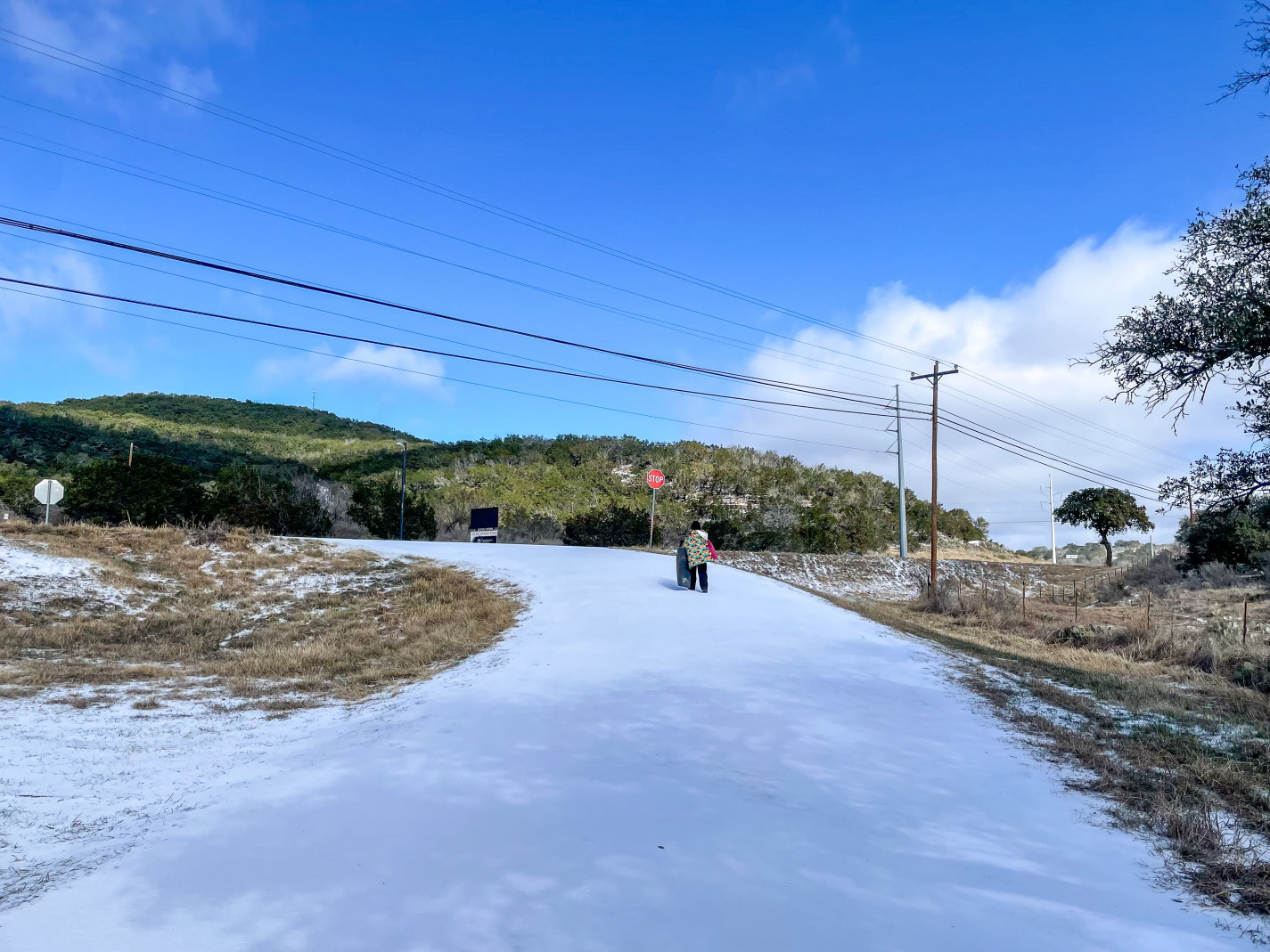


As an arctic blast settled into the Burnet area on Sunday overnight Monday Jan. 2526, businesses and schools shuttered and residents appeared to stay home to avoid frigid conditions.
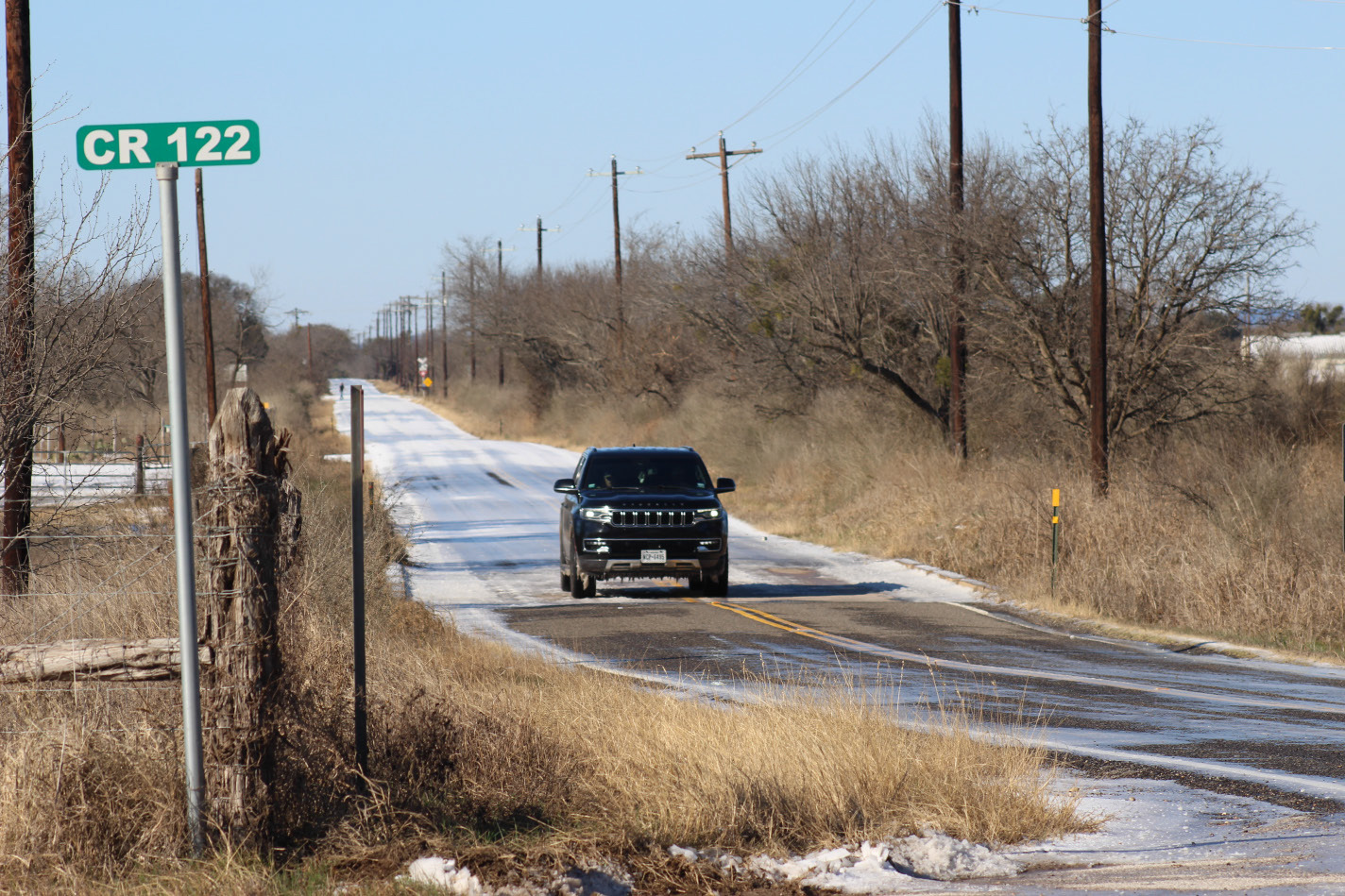
Other than reports of vehicles slipping on icy conditions through about mid-day on Monday, Jan. 26, authorities reported no major issues.
Anticipation of the freezing conditions prompted Burnet CISD to suspend activities.
“All classes, activities, and events scheduled for Monday are cancelled,” district officials wrote in a statement. “We will continue to closely monitor weather and road conditions and make decisions with safety as our top priority.
“Please continue to monitor our official communication channels for updates.”
Ark of Highland Lakes opened a warming center starting Saturday, Jan. 24 at First Methodist Church, 301 E. Graves in Burnet.
“We ended up with nobody in Burnet (Jan. 25-26), and one person in shelter in Marble Falls,” said Kevin Naumann, executive director of Ark of Highland Lakes. “Generally, as long as the power doesn’t go out, people find places to stay warm.
“We’re available in case people need help,” he added. “For the most part, we’re bundled up at home.”
The City of Burnet closed on Monday as well and delayed reopening the following day.
“Due to icy road conditions, City offices will have a delayed opening at 1:00 PM on Tuesday, January 27th to allow time for morning road assessments,” officials wrote on their social media page.
By mid afternoon Monday, Jan. 26, conditions had improved as temperature climbed to about 38 degrees.
By 7 p.m. conditions were expected to freeze again as temperatures were predicted to drop eventually back into the teens by Monday night, according to the National Weather Service (NWS).
On Jan. 26, NWS offered the following update of “What Occurred Overnight”:
• Freezing rain accumulations anywhere from a few hundredths of an inch to around 0.2 inches;
• Sleet accumulations anywhere from 0.1 to 1 inch;
• Precipitation has ended; and
• Significant travel impacts ongoing.
Officials then reported “What We Expect Rest of Today (Jan. 26) and Tonight”:
• Partial clearing, winds, and treatment helping with improvements on roads, outside of many areas in Hill Country and Austin metro area;
• Icy roads continue over Hill Country and Austin metro through Monday morning;
• Re-freeze potential tonight where any liquid or slush remains; • Hard freezes the next two nights with low wind chill values today into Monday morning;
• Continue to protect people, pets, pipes, and plants; and
• We also encourage everyone to check on vulnerable neighbors, particularly the elderly and those without reliable heat. By press time, an update on whether schools would resume by Wednesday was pending.